
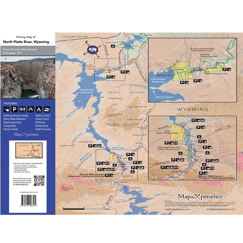
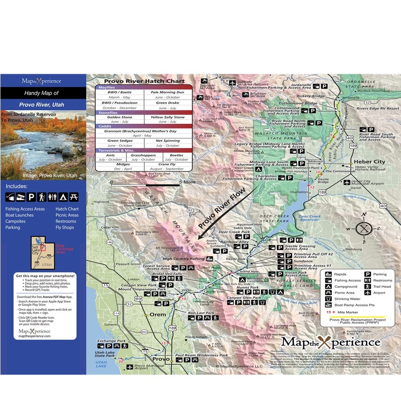
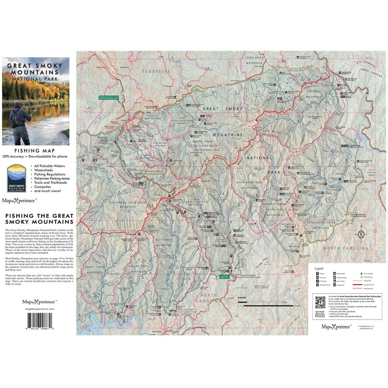
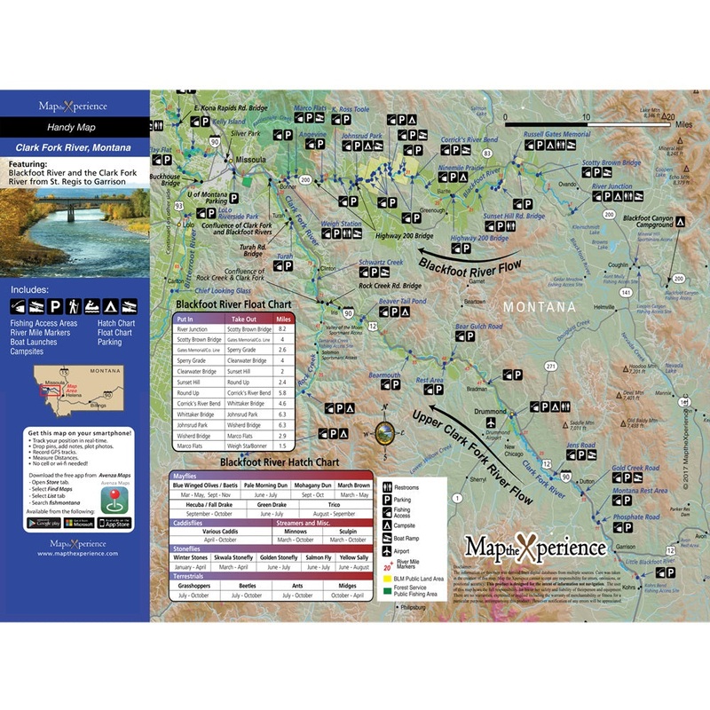
Description
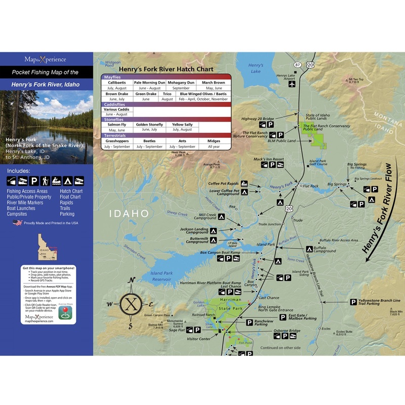
Henry’s Fork, Idaho – GPS Pocket Fishing Map
This compact, easy-to-carry guide unfolds from a convenient 3″x6″ to a detailed 15″x12″ map with an accompanying free mobile map worth $4.99. Covers the Henry’s Fork from Henry’s Lake to St. Anthony.
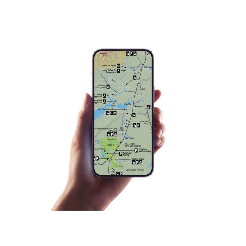
Avenza Map App Features:
Offline Access: Navigate without the need for cell service or internet.
Customizable Views and Spot Marking: Tailor your map and mark your favorite fishing spots.
Photo Tagging: Capture and geo-tag your catches directly on the map.
Features:
Compact Design: Unfolds from 3×6″ to 15×12″ for easy carrying and detailed navigation.
GPS Accuracy: Navigate with precision, ensuring you stay on the right track.
Comprehensive Coverage: Includes Federal, State, City, and County Public Lands.
Exclusive Access Information: Features parking locations not found on other maps.
Insect Hatch Chart: Essential for fly fishermen to select the right bugs.
Amenities: Nearby campgrounds and picnic areas are clearly marked.
Float Charts and Float Mileages: If applicable.
Boat Launches and Takeouts: If applicable
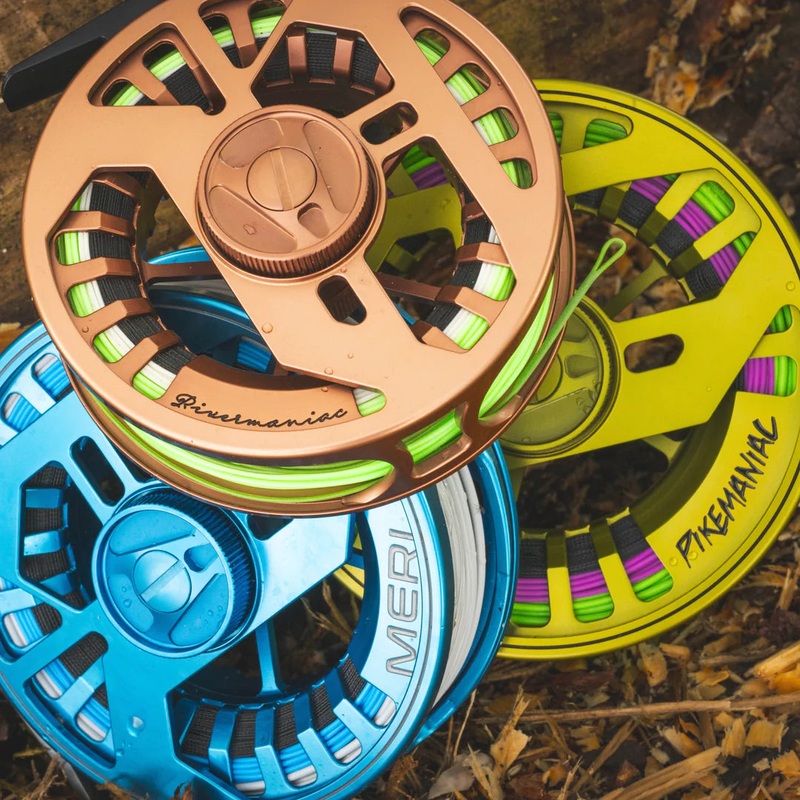 XLS Fully Sealed Reel||5-6wt Rivermaniac Reel||7-8wt Meri Reel||8-9wt Pikemaniac Reel||8-9wt Hybrid reel||9-11wt Kojamo reel
 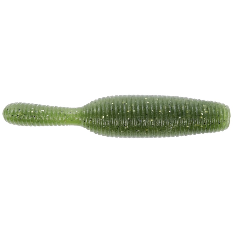 Yamamoto Yamatanuki|Baby Bass|Watermelon Red w/ Black Flake|Green Pumpkin w/ Black Flake|Green Pumpkin w/ Blue Flake|Brown/Purple Laminate|3.5|2.5
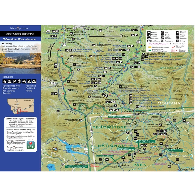
 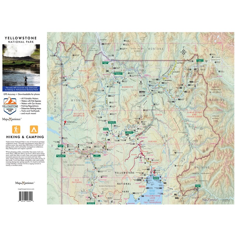 Yellowstone Nat'l Park Fishing Map
Reviews
There are no reviews yet.